
It had been a few weeks since I had last been for a walk. This was due to the deteriorating health of one of our three dogs. Roxanne Tinkerbell Chutney was a rescue dog that had been with us for 13 of her 14 years. She was part of our family and she gave us so much in her life. Three days ago we had to make an extremely difficult decision, her condition had become bad and it was time to let her go. She will forever be in our hearts. Rest in peace my beautiful girl.

I decided to do quite a long day on this visit to Suffolk, so I set off very early from Shropshire. As usual I had serious misgivings about catching a specific train from Manningtree, where I intended to park. The problem was the massive road works around Huntingdon and Cambridge, nearly every night the A14 is closed and diversions are put in place. The first diversion was at Huntingdon where yet again poor diversion signage meant that traffic was re-directed back down the A14 westwards, it was chaos with large articulated lorries reversing down the carriageway and cars trying to cross the carriageway. I managed to get past this diversion, but was later confronted with “A14 East Closed”, I along with many large lorries followed the diversion signs into Cambridge, which then disappeared and A14 west signs appeared! I saw a diverted traffic sign and headed towards Ely, trying to keep to the north while heading east. I finally re-joined the A14 near Newmarket. I had lost about 45 minutes. I must seriously look at an alternative route when I next drive to Essex.
I parked up in Manningtree in Essex and set off to walk to the Railway station where I caught the train to Ipswich. I had a tight bus connection in Ipswich and a 15 minute train delay meant I had just 3 minutes to catch my bus. I managed it …….just and was really relieved to get off the bus at Freston and begin my walk.
I would be following the Stour and Orwell Walk, however, like The Suffolk Coast path, it spends a good deal of time away from the river even when there are existing paths running alongside both rivers. The path follows an old farm track which leads through the grounds of Woolverstone School, now a fee paying school and from 1992 is now known as Ipswich High School. The path drops down to the Orwell River at Pin Mill. It’s still quite early and the local pub is just opening to serve coffee. I continue on through Chelmondiston Woods and out along a sea wall or bank that protects some of the lower lying lands. I can pick out a number of sites on the far bank of The Orwell that I had passed through a few weeks back.

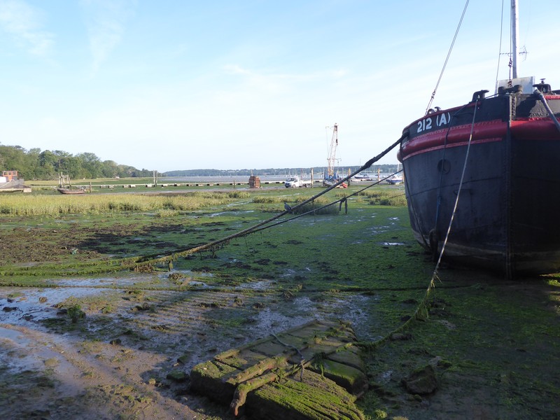


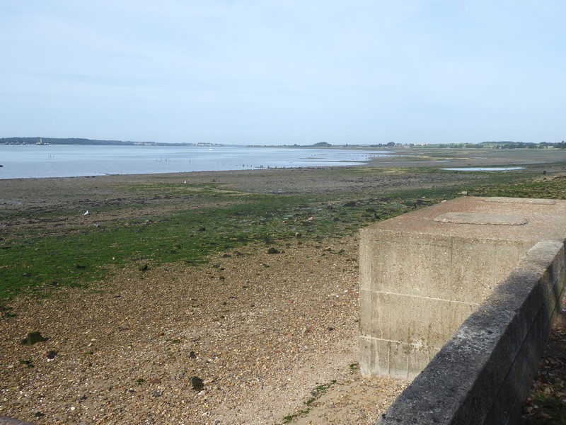
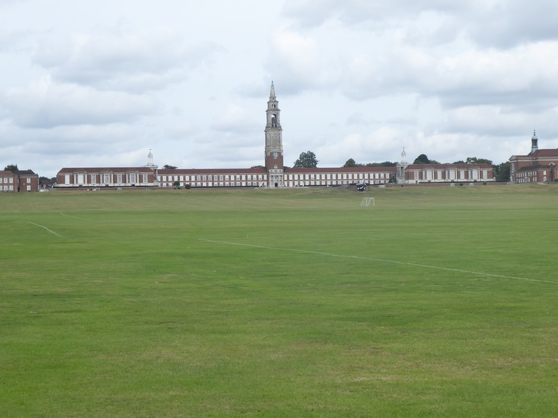
The river swings around to the right and I am rewarded with the imposing sight of the huge cranes of Felixstowe. As I approach the marina at Shotley Gate, a huge Stena ferry is departing from Parkeston Quay, it’s the Stena Hollandica bound for the Hook of Holland. As I pass around Shotley Point I say goodbye to the River Orwell and hello to the River Stour. I don’t see a great deal of Shotley Gate as I remain close to the river. The Stour and Orwell Path has disappeared inland for some miles. I continued around Erwarton Bay passing Erwarton Ness and around to Holbrook Bay. I was getting tantalising glimpses of the Royal Hospital School and could not wait to get a better view. I don’t think I have ever seen a school like this before, with its huge clock tower dwarfing the two storey wings extending either side of it. The huge open grassed playing fields extended virtually right down to the river. A very impressive building and setting.
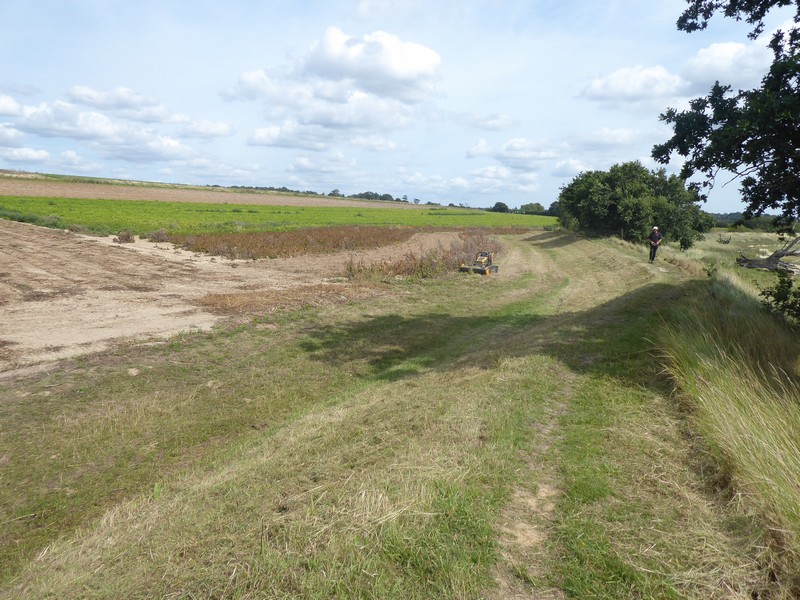
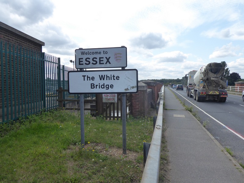
I eventually joined back up with the Stour and Orwell walk and continued along the river past Stutton Mill. I could now see Manningtree across the river, but first had to cross the railway line. Nearby to Marsh Farm I crossed the busy rail line via a bridge and headed down a concrete road past a sewage works. Further on I could see some construction work going on and close to the footpath I was on. Fortunately, a pedestrian walkway around the site was marked, but unfortunately, like this morning’s shenanigans around Cambridge onward signage was nowhere to be seen and a worker had to let me through the Arras fencing and into Cattawade. I joined the very busy A137 on a wide footpath and crossed over The River Stour via The White Bridge passing out of Suffolk into Essex. A simple walk along the sea bank into Manningtree was all that needed to get me back to my car.

Distance today = 22 miles
Total distance = 5,153 miles

That’s not the pretties entrance to Essex is it? Still it’s very pretty around Manningtree, you can walk out to Dedham Vale which is worth a visit. I missed out the ferry and walked around the Stour estuary too and quite enjoyed it.
I share your frustrations about overnight road works. I’ve got caught up in similar issues when the M25 has been closed at night and all traffic diverted off. Don’t really expect to get caught in a traffic jam after midnight but that is what happened. I’ve noticed the unfortunate tendancy for there to be a single “Diversion” sign when you leave the motorway but after that … nothing. I usually just end up following where everyone else seems to be going and hoping it’s right! I suppose there is never a good time to do such works, but it is irritating. You might fine the M11/A120 a reasonable alternative to avoid future A14 closures?
LikeLike